Walk 8 Dolforwyn Castle & Abermule
This walk starts and finishes at the Waggon and Horses in Lower Canal Road and includes Dolforwyn Castle and an optional detour into the village of Abermule. It is possible to make it a one-way walk and catch a bus back to Newtown from Abermule if desired. Much of the walk is off road and along minor roads and tracks.
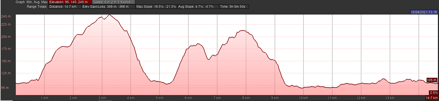
9.2 miles • 4.5 hrs plus castle & Abermule time • Strenuous
 Download Walk
Images


Directions
1
Begin at the Waggon and Horses at the junction of Lower Canal Road and Dolafon Road and walk down Dolafon Road towards the river. Cars can be parked in Dolafon Road. Go through the gap in the hedge at the bottom of the road (SO 114917). If muddy, there is a tarmac path on the left further down Dolafon Road. Climb up onto the river bank and turn left to follow the path along the top of the bank. At the end, the grass path drops down to a gate and joins a tarmac footpath/cycle route. Go under the pipe bridge and past the ‘Old Pump House’ which is behind a fence on your right. The Pump House drew water from the Severn to supply the head of the canal. It was originally operated by a water wheel, later by steam and eventually by a diesel engine. It ceased operation in the 1940s.
2
Just after the next gate turn left to take the steps (SO 118923) up to Lower Canal Road. Across the road, to the left is Lonesome Lane, with a sign reading ‘Woodland Walks 400m’. Walk up, passing 2 footpath signs at stiles on your left. The Woodland Walk – Coed y Graig is on your right 250m further on (SO 117928). Continue on up the lane which is now a green lane and often wet. When you reach a tarmac road, Upper Gwestydd Lane, turn right and go past Upper Gwestydd Farm and Old Upper Gwestydd on the right. Just past Derwen on the left go through the field gate on the right. Bear left through field and out through field gate back on to the stony track then go straight ahead to continue along the road, over 2 cattle grids and where the track turns sharp right, take the path into the wood on the left by a waymark post.
3
After passing the house below you, go through the pedestrian gate and down the steps on the right. Turn left at the shed and through the pedestrian gate into the wood. Continue through the wood until you reach a fence where you turn right and follow the fence down to a pedestrian gate (SO 129940) before the stream. Turn left and follow the fence to the gravelled track by a pond between two holiday cabins. Cross the track and go through the pedestrian gate to the right of the hedge. Cross the small stream and continue, through 2 field gates at a track, cross the field with friendly horses and cross the lane through two pedestrian gates. Bear right across the field, up the bank, and through the field gate under the hopper. Turn left and go through the pedestrian gate (SO 134939).
4
Follow a fence and stream on the left, through a pedestrian gate and continue through another pedestrian gate on to the road. Turn left to go over the bridge then cross the road and go down the steps on the right, over the little bridge and through the pedestrian gate. Follow the stream to another gate and back out on the B4389 road. Cross the road, enter the field and bear right up towards the right-hand oak of a pair of prominent oaks in the fence line and go through the field gate next to it. Go straight up the hill following the remains of an old hedge on your left and take the grassed over track through the field gate (SO 142942) to enter the wood. Follow the track past a derelict JCB and small quarry on the left and go through the field gate to follow the fence and wood on your left. Go through the pedestrian gate and continue downhill to go through the gate in the fence between the house and bungalow below. Cross the small field, through a pedestrian gate to cross another small field and out through a pedestrian gate on to the drive. Turn right up to the road.
5
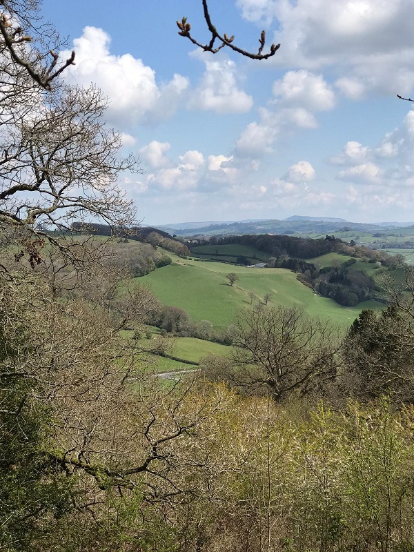
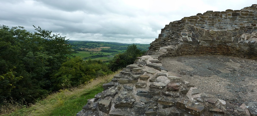
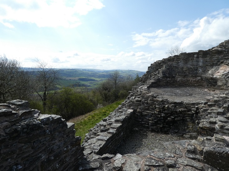
At the road you have two choices. Choice 1: Slightly shorter but steeper. Turn right on the road to a fingerpost pointing up into the woods on your left (SO 149947). Enter through the gap in the hedge and follow the steep footpath up through the wood. At the top go through two pedestrian gates passing in front of a cottage (SO 151949). Continue straight on, following the path up the bank to reach Dolforwyn Castle. This castle was built in 1273-1277 by Llywelyn the Last. See www.castlewales.com/dolforn.html for its description and history.
Choice 2: Less steep but 0.2 miles longer. Turn left up the road about 125 m to the sharp bend and go through the field gate on the right. Follow the farm track a short distance. (The track goes to where you want to go but is not the right of way). The right of way goes up to the left following the hedge line to another field gate in poor condition. (You may have to climb it). Continue left uphill till you reach a field gate on your left where you turn right back downhill across the field and go through a field gate at the original farm track or over an informal stile. Cross the track and continue with the hedge on your left and go through the pedestrian gate, with a badger door, into the wood. Turn right and follow the path through the wood, through a pedestrian gate by the cottage and turn immediately left on to the track leading left to the castle.
6
After visiting the castle, return to the junction of the tracks at the small green sign. Follow the larger track on the left down to the lane. Turn right and continue until you see a fingerpost on your left pointing to Abermiwl (SO 149947). Go through the gate here and walk downhill keeping the field hedge on your left. Continue until you reach a Bridleway fingerpost (SO 150946) where you bear right. At the bottom of the field go through a gate on to a tarmac lane.
7
Turn left and immediately right to cross the bridge over the end of the canal lock. Once across the canal turn right on the towpath to return to Newtown.
(To detour into Abermule or to catch a bus back, turn left on the canal (SO 152944) and walk along the towpath until you come to a fingerpost (SO 162952) showing that Berriew is 5 miles ahead, Newtown is 5.6 miles behind and Abermule is 500 metres to your left. Here you will see the road bridge to Abermule over the River Severn which has the inscription ‘”This Second Iron Bridge constructed in the county of Montgomery was erected in the year 1852″. Abermule has a shop and a pub, the Abermule Hotel, which is open daily except Tuesday. You can also catch either the 71 or X75 bus from Abermule back to Newtown. The main stop is on the same side of the road for both directions, near the village shop. Buses go every 1 or 2 hours during the day every day except Sundays. For current schedule information see the notice board at the stop, call Traveline Cymru at 0871 2002233 or visit the web site, www.traveline.cymru/. To return to the walk you must retrace your steps across the iron bridge to the canal.)
8
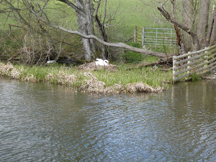
Either from the Abermule detour or the canal lock continue along the canal toward Newtown, eventually passing the Pwll Penarth Nature Reserve on your left. This reserve is operated by the Montgomeryshire Wildlife Trust and there are two hides available for bird watching. Details of the reserve, including a map, can be found at www.montwt.co.uk/pwll.html
9
You will also pass Llanllwchaiarn Church on your right, and the Old Pump House on your left. Go through the gate after the Pump House, taking the upper path along the flood defence bank. Go through a small gap in the hedge on the right and on to Dolafon Road. Continue straight ahead which will bring you back to the Waggon and Horses on your right.
Waggon and Horses
This local pub run by Neil and Jackie offers excellent bar service with real ale and meals in their Garden Restaurant. Open lunchtime during the week by arrangement, phone 01686 625790.
More Walks